Historic background
Nancy Island in Wasaga Beach, commemorates a pivotal moment in Canadian history during the War of 1812. Named after the schooner HMS Nancy, the island marks the site where the vessel was scuttled by British forces on August 14, 1814, to prevent its capture by American ships. Originally built in Detroit for the North West Company, HMS Nancy was later pressed into British service as a supply ship. Under attack near the mouth of the Nottawasaga River, Lieutenant Miller Worsley ordered the vessel destroyed, and its charred hull now rests on the island, preserved as a historic site since 1928.
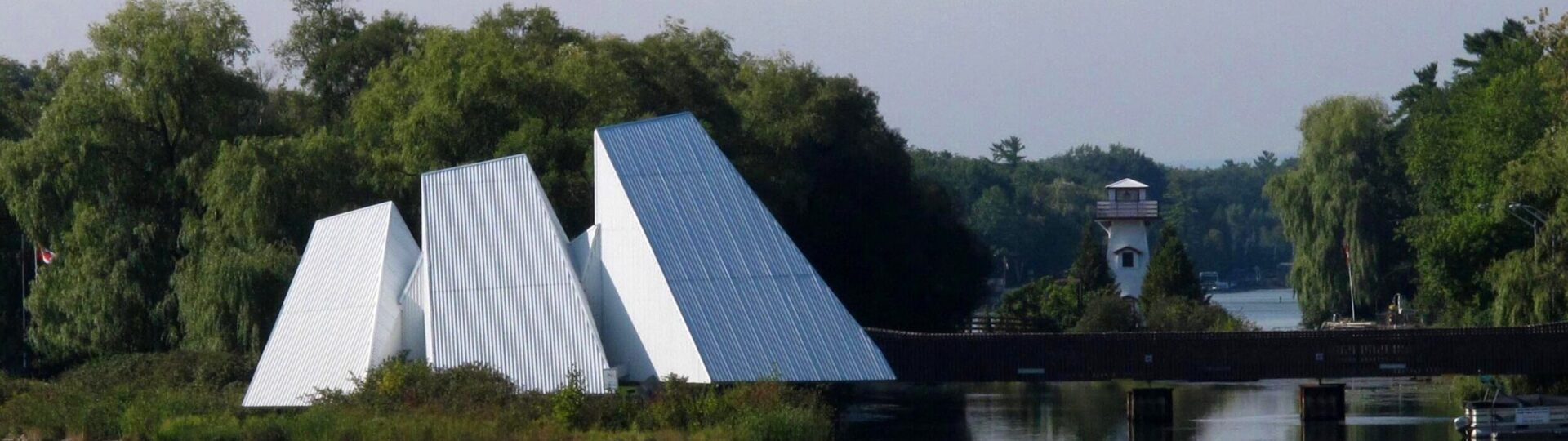
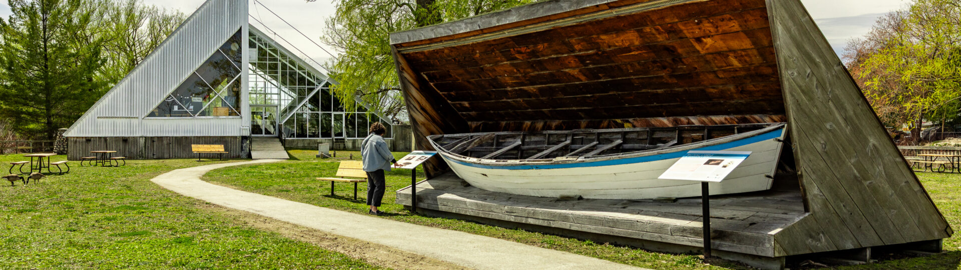
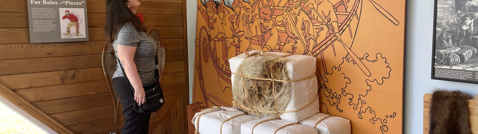
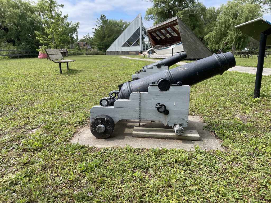
Today, Nancy Island Historic Site offers visitors a glimpse into early 19th-century naval warfare and frontier life. The site features a museum housing artifacts from HMS Nancy, a reconstructed blockhouse, and a theatre that recounts the dramatic events of the battle. Surrounded by the scenic beauty of Wasaga Beach, the island serves not only as a tribute to Canadian resilience but also as an educational destination that brings the War of 1812 to life for new generations.

Construction of the Nancy
The HMS Nancy was constructed in 1789 at the British port of Detroit, specifically for use in the fur trade. Oversight of the schooner’s building was handled by John Richardson of Richardson, Forsyth and Company, based in Montreal. Once completed, the Nancy measured close to 80 feet long, had a beam of 22 feet, and a hold depth of 8 feet. That same year, Richardson wrote to his business partner from Detroit:
“The schooner will be a perfect masterpiece of workmanship and beauty. The expense to us will be great, but there will be the satisfaction of her being strong and very durable. Her floor-timbers, keel, keel-son, stem, and lower futtocks are oak. The transom, stern-post, upper futtocks, top timbers, beams and knees are all red cedar. She will carry 350 barrels.”
The ship’s figurehead—described as “a lady dressed in the present fashion, and with a hat and a feather”—was carved by Skelling of New York. It’s believed the Nancy was named in honour of either John Richardson’s wife or his daughter.
The War of 1812
When the United States declared war on Britain in 1812, the Nancy was commissioned for military service by Lieutenant-Colonel St. George, who commanded the local garrison. In an inventory prepared by Colonel Matthews Willot for Sir Isaac Brock, the schooner was noted as being armed with six four-pound carriage guns and six swivel guns.
At the start of the war, there were three primary supply routes connecting Montreal to the Northwest:
- The first followed the Ottawa and French Rivers into Georgian Bay.
- The second traveled through Lakes Ontario, Erie, St. Clair, and Huron.
- The third was an overland route beginning at York (now Toronto), moving north along Yonge Street to Holland Landing and the Holland River. From there, it passed through Lake Simcoe to Kempenfeldt Bay (present-day Barrie), where the Nine Mile Portage linked to Willow Creek, the Nottawasaga River, and ultimately Lake Huron.
This final route became the principal supply corridor during the war’s last year, offering a more secure and efficient path to the western front.
Escape of HMS Nancy
On September 10, 1813, while the Nancy was stationed at Fort Mackinac, the British naval forces suffered a major defeat in the Battle of Lake Erie. This left the Nancy as the only remaining British vessel operating in the Upper Great Lakes.
When Captain Alexander Mackintosh returned with the schooner to the mouth of the St. Clair River on October 5, he discovered that both Detroit and Amherstburg had fallen into American hands. Awaiting his arrival were two armed schooners and a gunboat, and by noon the next day, the Nancy came under fire. On October 7, Mackintosh set sail for Sault Ste. Marie, where the vessel remained for the winter.
Following the British loss at Lake Erie, American forces began planning to retake Fort Mackinac, which they had surrendered on July 17, 1812. In the spring of 1814, the Nancy completed three supply runs between Fort Mackinac and the mouth of the Nottawasaga River. On July 3, 1814, as the American fleet departed Detroit en route to Fort Mackinac, the Nancy was stationed at the Nottawasaga supply depot for a fourth time. Under the command of Royal Navy Lieutenant Miller Worsley, the schooner was moved approximately 3 kilometres (2 miles) upriver.
There, concealed and shielded by a blockhouse, the Nancy lay in wait.
Discovery of HMS Nancy
On August 14, 1814, three American ships—Niagara, Tigress, and Scorpion—under Captain Sinclair arrived at the mouth of the Nottawasaga River, expecting the British schooner Nancy to be en route from Fort Mackinac. Her location was only discovered when American wood-gathering parties stumbled upon her hidden upriver.
The clash was swift and one-sided. Lieutenant Miller Worsley commanded a small force of 22 sailors, 23 Anishinaabe-Ojibwe led by Lieutenant Ramsay Livingston, and nine French Canadian voyageurs. They were armed with two 24-pounder carronades and one 6-pounder long gun. In contrast, the Americans brought 500 men and heavy firepower, including eighteen 32-pounder carronades, two 24-pounder long guns, and a 5.5-inch howitzer. Anchoring in the bay, Sinclair launched a bombardment across the narrow strip of land separating the river from the bay.
Facing overwhelming odds, Worsley chose to destroy the Nancy rather than let her be captured. Before the demolition could be completed, a direct hit ignited the blockhouse, setting the schooner ablaze. She burned to the waterline and sank, while the British force slipped away into the forest unpursued.
Afterward, the Scorpion and Tigress remained to block supply routes to Fort Mackinac. They eventually obstructed the river mouth with felled trees and patrolled the north shore, hoping to intercept fur-laden canoes.
Nancy Island
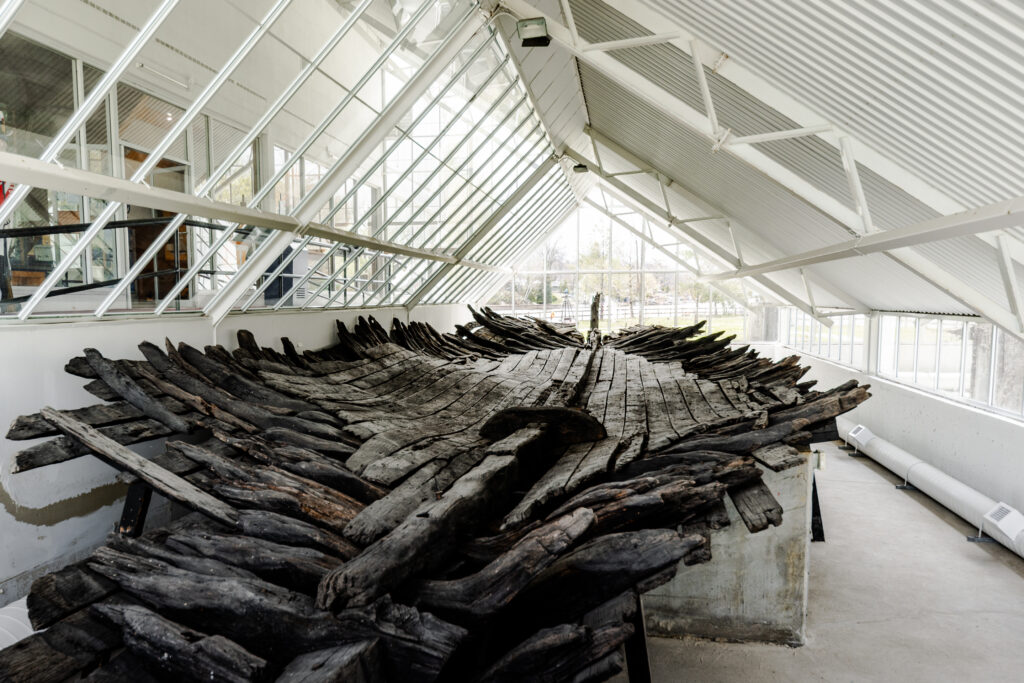
Gradually, the river currents deposited silt and sand about the sunken hull and an island was formed.
On July 1, 1911, Mr. C.J.H. Snider located the hull, which was visible just beneath the water. It was not until August 1924, when an American 24-pounder round shot was found in the riverbank by Dr. F.J. Conboy that interest was renewed. The long-covered hull was rediscovered by Dr. Conboy, whose interest was spurred by Mr. Snider, during the summer of 1925.
The Dominion and Provincial Governments, as well as many individuals, became interested in the historic site and in 1928 the hull was raised and placed on the island. On August 14, 1928, 114 years after the gallant defence of the Nancy, the Nancy museum was officially opened, on the island she helped to form, to commemorate this episode in the War of 1812.
Schooner Town
Following the capture of the American ships Tigress and Scorpion in September 1814, Lieutenant Worsley and his crew built winter quarters about four miles inland from the mouth of the Nottawasaga River. Plans to establish a permanent naval base at Penetanguishene were later abandoned with the conclusion of the War of 1812.
By the summer of 1815, the quarters at Schooner Town had been destroyed by fire. In September, Lieutenant Wingfield—now in command of the Scorpion, renamed Confiance—left three men behind to begin rebuilding.
That October, Commodore Sir Edward Owen selected Schooner Town as the location for a “temporary naval establishment on Lake Huron,” appointing Captain P.S. Hambly as its commanding officer. The site was intended for vessel repairs, bateau construction for transporting supplies, and protection of commissary stores at the river’s mouth. In his orders, Captain Hambly was instructed to:
“Cause such houts as are absolutely necessary for the comfort of the officers and the men and preservation of the stores to be erected at Nottawasaga but considering this a temporary arrangement only he is to avoid incurring unnecessary expense there in.”
When Lieutenant Wingfield returned from Drummond Island in November, he found the buildings occupied and his own residence repurposed as a storeroom, prompting additional construction. Reflecting on the experience, Wingfield remarked: “One summer was sufficient to convince us that this was not the most eligible situation for a naval Establishment.”
An unsheltered bay for vessels, strong winds, a shifting sand bar and lack of suitable dockyard and storeroom facilities led Sir E. Owen to recommend transfer of Schooner Town to Penetanguishene in July 1816. Implementation of this decision was delayed as the road to Penetanguishene was rough and very swampy. Signing of the Rush-Bagot agreement in April 1817 led to the disbanding of the Naval Squadron on Lake Huron and by July first the entire squadron was paid off and laid up at Penetanguishene. Thus, Schooner Town was abandoned.
Schooner Town is now preserved with the Schooner Town parkette.
The Trail of the Caribou
On August 8, 1934, Wasaga Beach became the launch site for the first successful overseas flight from Canada. Its long, flat shoreline made it an ideal natural runway for the aircraft Trail of the Caribou, piloted by Canadians James Ayling and Leonard Reid.
The flight followed a failed attempt the previous summer, when British aviators Captain James Mollison and Amy Johnson tried to break the world’s long-distance record by flying to Baghdad. Despite local excitement and careful preparations, strong crosswinds caused their plane, Seafarer II, to crash on takeoff.
A year later, Ayling and Reid purchased the damaged aircraft, renamed it Trail of the Caribou, and prepared for their own transatlantic journey. With help from De Havilland engineers and local volunteers, four miles of beach were cleared and leveled for takeoff. At 6:12 a.m., the plane lifted off after a mile-long run, circled Georgian Bay to gain altitude, and headed east.
The flight faced challenges: fog, carburetor icing, and increased fuel consumption. Originally aiming for Baghdad, the pilots adjusted course and landed in Heston, England after 30 hours and 55 minutes in the air. Though they didn’t break the distance record, they became the first to fly non-stop from Canada to Britain—a milestone in aviation history.
For years afterward, Wasaga’s beach continued to serve as a runway for small planes until rising motor traffic made it unsafe. Today, seaplanes still land offshore. A stone cairn was unveiled in 1958 at Nancy Island Historic Site to commemorate the flight, and in 1984, the Town of Wasaga Beach published G. Ray Gibson’s detailed account in Trail of the Caribou.
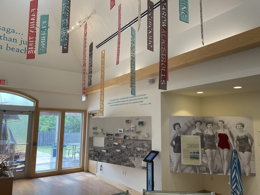
Early resort community
Wasaga Beach has long been a beloved summer destination. By the early 1900s, improved railways and roads made it more accessible, and hotels and cottages began popping up along the river. A steel bridge built in 1909 across the Nottawasaga River boosted access to the beachfront, though the beach itself remained the main route for cars, horses, and bicycles.
The resort scene truly began in 1912 with the Capstan Inn, the first hotel on the beach. After a fire destroyed it in 1915, it was rebuilt and became a local landmark. Soon after, the Dardanella Dance Hall opened across the street, offering evening entertainment for hotel guests. Over the following decades, more hotels followed—like the Wasaga Inn, Breakers Hotel, Hiawatha Inn, and Dyconia.
By the 1930s, Wasaga Beach was booming. Playland Park, a permanent amusement area, became a major attraction with its ferris wheel, carousel, roller coaster, arcade, and more. It remained a staple until the early 1980s. During WWII, sunny weekends could draw crowds of up to 100,000 people.
From 1935 to 1950, the beach also hosted thrilling motorcycle races, attracting top riders and up to 10,000 spectators. Racers sped along the sandy shoreline at over 100 miles per hour.
Though vehicles are no longer allowed on the beach, Wasaga remains one of Ontario’s top tourist spots, welcoming up to two million visitors annually.